| Mesoscale Discussion 68 | |
| < Previous MD | |

|
|
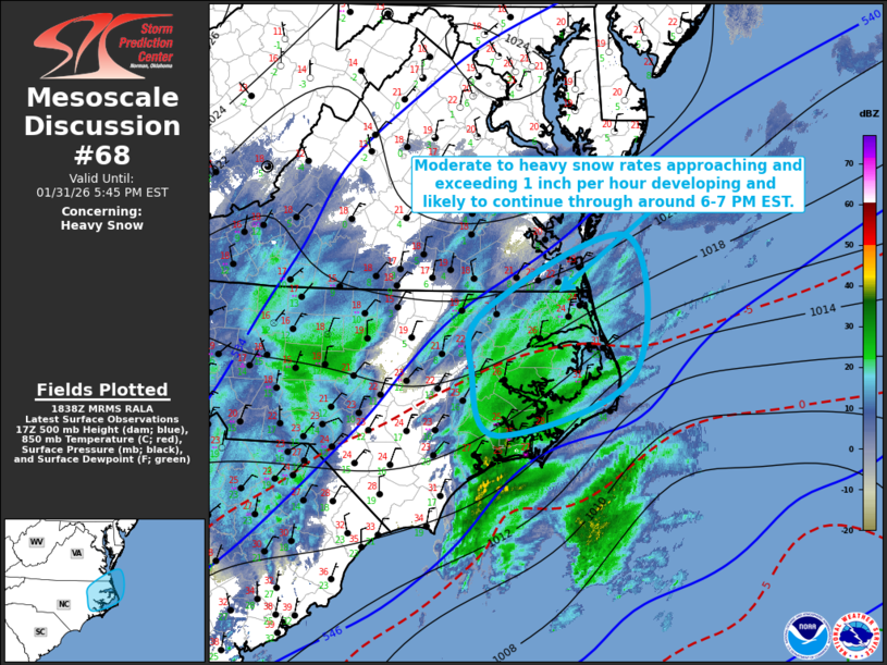
Mesoscale Discussion 0068 NWS Storm Prediction Center Norman OK 1240 PM CST Sat Jan 31 2026 Areas affected...parts of eastern North Carolina and adjacent southeastern Virginia Concerning...Heavy snow Valid 311840Z - 312245Z SUMMARY...A period of sustained moderate to heavy snow rates approaching and occasionally exceeding 1 inch per hour appears to be developing and likely to continue through around 6-7 PM EST. DISCUSSION...Longer term radar loops indicate increasing precipitation rates within a zone of stronger lower/mid-tropospheric warm advection and frontogenetic forcing, extending from just inland of North Carolina and southeastern Virginia coastal areas east-northeastward offshore. Across and inland of the coast, thermodynamic profiles are largely sub-freezing, with Rapid Refresh forecast soundings indicating modest precipitable water around .4 to .5 inches along this corridor. These same soundings suggest lift becoming maximized within temperatures most conducive to large dendritic ice crystal growth (roughly in the 700-600 mb layer) through 21-00Z, and becoming focused near the Virginia/North Carolina border, near but perhaps remaining just south of the Norfolk/Virginia Beach vicinity, before stronger forcing tends to shift east of coastal areas this evening. It appears that this probably will be accompanied by a sustained period of moderate to heavy snow rates approaching and occasionally exceeding 1 inch per hour. ..Kerr.. 01/31/2026 ...Please see www.spc.noaa.gov for graphic product... ATTN...WFO...AKQ...MHX...RAH... LAT...LON 36347730 37167535 35607528 34937712 35637749 36347730 |
|
|
Top/All Mesoscale Discussions/Forecast Products/Home |
|