| Mesoscale Discussion 46 | |
| < Previous MD Next MD > | |
|
|
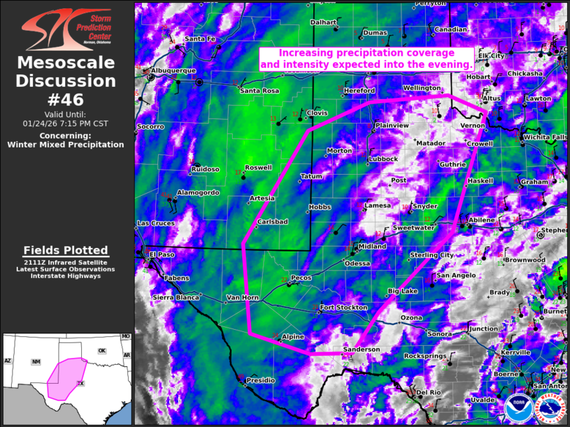
   Mesoscale Discussion 0046
   NWS Storm Prediction Center Norman OK
   0317 PM CST Sat Jan 24 2026

   Areas affected...Southeast New Mexico into West Texas and far
   southwest Oklahoma

   Concerning...Winter mixed precipitation

   Valid 242117Z - 250115Z

   SUMMARY...An increase in precipitation coverage and intensity is
   expected into the evening.

   DISCUSSION...A potent mid-level shortwave trough can be seen across
   northern Mexico on water vapor imagery. This trough is starting to
   take on a negative tilt as it advances towards Far West Texas. As
   this occurs, large-scale ascent will strengthen across the southern
   High Plains.

   This will result in an increase in coverage and intensity of
   precipitation late this afternoon and into the evening. Regional
   radar imagery shows this expansion beginning already with cooling
   cloud tops upstream across northern Mexico and Far West Texas.
   Forecast soundings support sleet across much of this area late this
   afternoon and into early evening. However, the sleet/snow line will
   move gradually southeast through the evening as temperatures cool
   aloft.

   Sleet accumulation of 0.1 to 0.2 inches per hour and snow
   accumulations of 1 inch per hour are expected as forcing increases.
   Particularly closer to 00Z.

   ..Bentley.. 01/24/2026

   ...Please see www.spc.noaa.gov for graphic product...

   ATTN...WFO...OUN...SJT...LUB...AMA...MAF...ABQ...

   LAT...LON   34160314 34690180 34790008 34479925 32320005 30890161
               30150217 30130305 30490430 32110449 34160314
|
|
|
Top/All Mesoscale Discussions/Forecast Products/Home |
|