|
|
| Mesoscale Discussion 2161 | |

|
|
   Mesoscale Discussion 2161
   NWS Storm Prediction Center Norman OK
   0659 PM CDT Sun Oct 19 2025

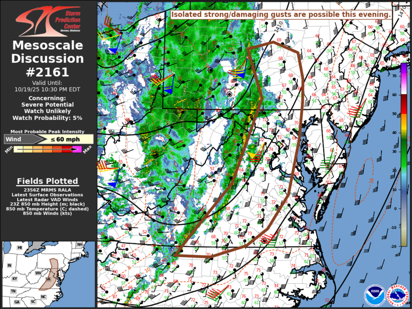
   Areas affected...Central PA into parts of the Mid Atlantic

   Concerning...Severe potential...Watch unlikely

   Valid 192359Z - 200230Z

   Probability of Watch Issuance...5 percent

   SUMMARY...Isolated strong/damaging gusts are possible this evening.

   DISCUSSION...Multiple low-topped rain bands are ongoing this evening
   from central PA into parts of the Mid Atlantic, along and just ahead
   of an eastward-moving cold front. Buoyancy is very weak to
   negligible (with SBCAPE of around 100-200 J/kg or less) and no
   lightning is being produced with these bands, but strong ascent
   related to a vigorous mid/upper-level trough approaching the region
   will sustain this activity through the evening, with some
   consolidation possible along the cold front. Peak wind gusts have
   generally been in the 40-50 mph range, but with flow increasing into
   the 35-50 kt range within the 1-3 km AGL layer (as sampled by
   regional VWPs), isolated damaging gusts will be possible within the
   weakly convective rain bands as they approach the Mid Atlantic
   region.

   ..Dean/Guyer.. 10/19/2025

   ...Please see www.spc.noaa.gov for graphic product...

   ATTN...WFO...PHI...AKQ...CTP...LWX...RAH...RNK...

   LAT...LON   37757677 36977738 36587799 36307902 36338003 36887951
               38027840 39997754 41137796 41297719 41037644 40437630
               39887631 39017644 37757677

   MOST PROBABLE PEAK WIND GUST...UP TO 60 MPH
|
|
|
Top/All Mesoscale Discussions/Forecast Products/Home |
|