| Mesoscale Discussion 12 | |
| < Previous MD | |

|
|
   Mesoscale Discussion 0012
   NWS Storm Prediction Center Norman OK
   0708 AM CST Fri Jan 09 2026

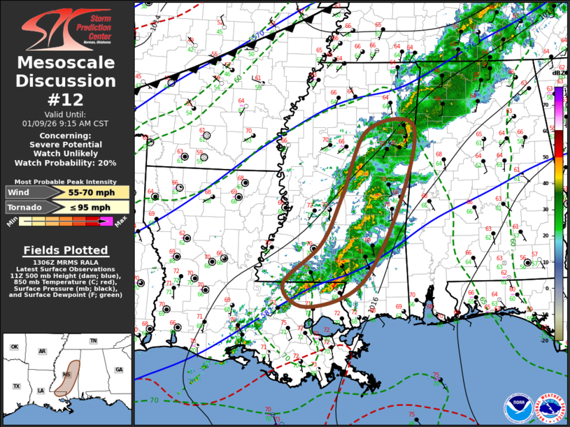
   Areas affected...parts  of southeastern Louisiana through portions
   of southern and central Mississippi

   Concerning...Severe potential...Watch unlikely

   Valid 091308Z - 091515Z

   Probability of Watch Issuance...20 percent

   SUMMARY...Potential for an additional brief tornado and/or locally
   damaging wind gusts is generally not expected to continue in the
   near term.  However, trends will continue to be monitored.

   DISCUSSION...A couple of intensifying near-surface cyclonic
   circulations have been recently observed within scattered ongoing
   thunderstorm development.  This appears to have coincided with
   subtle surface warming and moistening sufficient to contribute to
   weak boundary-layer based instability, based on forecast soundings
   and the 12Z sounding from Jackson.  But, this also appears to be
   occurring as low-level hodographs shrink and trend more linear, in
   the wake of the initial short wave trough now accelerating northeast
   of the middle Mississippi Valley.  As a result, potential for
   further similar mesovortex intensification accompanied by the risk
   for a brief tornado and/or damaging wind gusts seems likely to
   diminish shortly, if it hasn't already.

   ..Kerr/Hart.. 01/09/2026

   ...Please see www.spc.noaa.gov for graphic product...

   ATTN...WFO...MOB...MEG...JAN...LIX...

   LAT...LON   33758928 33858826 32448857 30968940 30549056 30959106
               31689024 32588979 33758928

   MOST PROBABLE PEAK TORNADO INTENSITY...UP TO 95 MPH
   MOST PROBABLE PEAK WIND GUST...55-70 MPH
|
|
|
Top/All Mesoscale Discussions/Forecast Products/Home |
|