
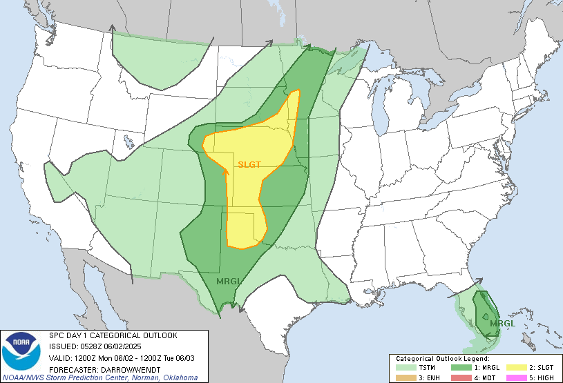
Risk Areas & Main Hazards:
SLIGHT Risk:
• High Plains through SW Minnesota
• Main threats: Scattered severe storms with damaging winds & large hail
• Storms: Supercells possible early (hail/low tornado risk) → likely become clusters/lines with damaging winds and large hail by late afternoon & evening
• Key cities: Amarillo (TX), Sioux Falls (SD), Sioux City (IA), Cheyenne (WY), Grand Island (NE)MARGINAL Risk:
• Southern High Plains (TX Panhandle, OK) & South Florida
• In the southern High Plains: late afternoon/evening storms, with locally damaging winds & some hail
• In S Florida: Scattered to widespread thunderstorms through afternoon/evening, with isolated strong winds/small hail possible
Tornado Risk:
🌪️A limited/brief tornado can’t be ruled out in early High Plains supercells, but wind and hail are the primary threats today.
Stay weather-aware if you’re in the risk zones. Review safety plans and be ready to act on watches or warnings!
Full Outlook: https://www.spc.noaa.gov/products/outlook/day1otlk.html