Note:
The expiration time in the watch graphic is amended if the watch is
replaced, cancelled or extended. Note: Click for Watch Status Reports.
SEL1
URGENT - IMMEDIATE BROADCAST REQUESTED
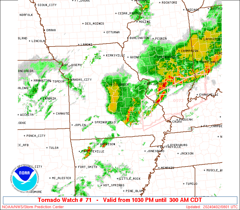
Tornado Watch Number 71
NWS Storm Prediction Center Norman OK
215 PM EDT Sun Mar 30 2025
The NWS Storm Prediction Center has issued a
* Tornado Watch for portions of
Northeast Illinois
Northern Indiana
Extreme southwest Lower Michigan
Lake Michigan
* Effective this Sunday afternoon and evening from 215 PM until
800 PM EDT.
* Primary threats include...
A couple tornadoes possible
Widespread damaging wind gusts to 70 mph likely
Scattered large hail events to 1.5 inches in diameter possible
SUMMARY...A developing squall line in central Illinois will spread
quickly northeastward into Indiana through the afternoon, with the
potential for swaths of 60-70 mph thunderstorm gusts and a couple of
tornadoes with embedded circulations. Additional storms will also
form across northeast Illinois with the potential to produce
damaging winds, isolated large hail (1-1.5 inches in diameter) and a
couple of tornadoes.
The tornado watch area is approximately along and 85 statute miles
east and west of a line from 35 miles northwest of South Bend IN to
5 miles south of Lafayette IN. For a complete depiction of the watch
see the associated watch outline update (WOUS64 KWNS WOU1).
PRECAUTIONARY/PREPAREDNESS ACTIONS...
REMEMBER...A Tornado Watch means conditions are favorable for
tornadoes and severe thunderstorms in and close to the watch
area. Persons in these areas should be on the lookout for
threatening weather conditions and listen for later statements
and possible warnings.
&&
OTHER WATCH INFORMATION...CONTINUE...WW 70...
AVIATION...Tornadoes and a few severe thunderstorms with hail
surface and aloft to 1.5 inches. Extreme turbulence and surface wind
gusts to 60 knots. A few cumulonimbi with maximum tops to 500. Mean
storm motion vector 22045.
...Thompson
   SEL1

   URGENT - IMMEDIATE BROADCAST REQUESTED
   Tornado Watch Number 71
   NWS Storm Prediction Center Norman OK
   215 PM EDT Sun Mar 30 2025

   The NWS Storm Prediction Center has issued a

   * Tornado Watch for portions of
     Northeast Illinois
     Northern Indiana
     Extreme southwest Lower Michigan
     Lake Michigan

   * Effective this Sunday afternoon and evening from 215 PM until
     800 PM EDT.

   * Primary threats include...
     A couple tornadoes possible
     Widespread damaging wind gusts to 70 mph likely
     Scattered large hail events to 1.5 inches in diameter possible

   SUMMARY...A developing squall line in central Illinois will spread
   quickly northeastward into Indiana through the afternoon, with the
   potential for swaths of 60-70 mph thunderstorm gusts and a couple of
   tornadoes with embedded circulations.  Additional storms will also
   form across northeast Illinois with the potential to produce
   damaging winds, isolated large hail (1-1.5 inches in diameter) and a
   couple of tornadoes.

   The tornado watch area is approximately along and 85 statute miles
   east and west of a line from 35 miles northwest of South Bend IN to
   5 miles south of Lafayette IN. For a complete depiction of the watch
   see the associated watch outline update (WOUS64 KWNS WOU1).

   PRECAUTIONARY/PREPAREDNESS ACTIONS...

   REMEMBER...A Tornado Watch means conditions are favorable for
   tornadoes and severe thunderstorms in and close to the watch
   area. Persons in these areas should be on the lookout for
   threatening weather conditions and listen for later statements
   and possible warnings.

   &&

   OTHER WATCH INFORMATION...CONTINUE...WW 70...

   AVIATION...Tornadoes and a few severe thunderstorms with hail
   surface and aloft to 1.5 inches. Extreme turbulence and surface wind
   gusts to 60 knots. A few cumulonimbi with maximum tops to 500. Mean
   storm motion vector 22045.

   ...Thompson
Note:
The Aviation Watch (SAW) product is an approximation to the watch area.
The actual watch is depicted by the shaded areas.
   SAW1
   WW 71 TORNADO IL IN MI LM 301815Z - 310000Z
   AXIS..85 STATUTE MILES EAST AND WEST OF LINE..
   35NW SBN/SOUTH BEND IN/ - 5S LAF/LAFAYETTE IN/
   ..AVIATION COORDS.. 75NM E/W /28NW GIJ - 14SSE BVT/
   HAIL SURFACE AND ALOFT..1.5 INCHES. WIND GUSTS..60 KNOTS.
   MAX TOPS TO 500. MEAN STORM MOTION VECTOR 22045.

   LAT...LON 42058515 40348532 40348854 42058846

   THIS IS AN APPROXIMATION TO THE WATCH AREA.  FOR A
   COMPLETE DEPICTION OF THE WATCH SEE WOUS64 KWNS
   FOR WOU1.
Watch 71 Status Report Messages:
STATUS REPORT #2 ON WW 71

VALID 302030Z - 302140Z

SEVERE WEATHER THREAT CONTINUES RIGHT OF A LINE FROM 5 S DNV TO
10 NE LAF TO 30 SSE VPZ TO 45 SSE RAC.

FOR ADDITIONAL INFORMATION SEE MESOSCALE DISCUSSION 305

..THORNTON..03/30/25

ATTN...WFO...LOT...IWX...

&&

STATUS REPORT FOR WT 71

SEVERE WEATHER THREAT CONTINUES FOR THE FOLLOWING AREAS

INC001-003-009-017-033-039-049-053-069-075-085-087-091-099-103-
113-127-131-141-149-151-169-179-181-183-302140-

IN
.    INDIANA COUNTIES INCLUDED ARE

ADAMS		     ALLEN		 BLACKFORD
CASS		     DE KALB		 ELKHART
FULTON		     GRANT		 HUNTINGTON
JAY		     KOSCIUSKO		 LAGRANGE
LA PORTE	     MARSHALL		 MIAMI
NOBLE		     PORTER		 PULASKI
ST. JOSEPH	     STARKE		 STEUBEN
WABASH		     WELLS		 WHITE
WHITLEY
$$


MIC021-023-027-149-302140-

MI
.    MICHIGAN COUNTIES INCLUDED ARE

BERRIEN 	     BRANCH		 CASS
ST. JOSEPH
$$


LMZ043-046-080-745-779-302140-

CW

.    ADJACENT COASTAL WATERS INCLUDED ARE

NEW BUFFALO MI TO ST JOSEPH MI

MICHIGAN CITY IN TO NEW BUFFALO MI

LAKE MICHIGAN MICHIGAN CITY IN TO ST. JOSEPH MI 5 NM OFFSHORE TO
MID-LINE OF LAKE.

BURNS HARBOR TO MICHIGAN CITY IN

LAKE MICHIGAN FROM WILMETTE HARBOR TO MICHIGAN CITY IN 5NM
OFFSHORE TO MID LAKE

$$
THE WATCH STATUS MESSAGE IS FOR GUIDANCE PURPOSES ONLY.  PLEASE
REFER TO WATCH COUNTY NOTIFICATION STATEMENTS FOR OFFICIAL
INFORMATION ON COUNTIES...INDEPENDENT CITIES AND MARINE ZONES
CLEARED FROM SEVERE THUNDERSTORM AND TORNADO WATCHES.
$$

STATUS REPORT #1 ON WW 71

VALID 301850Z - 301940Z

THE SEVERE WEATHER THREAT CONTINUES ACROSS THE ENTIRE WATCH AREA.

..WENDT..03/30/25

ATTN...WFO...LOT...IWX...

&&

STATUS REPORT FOR WT 71

SEVERE WEATHER THREAT CONTINUES FOR THE FOLLOWING AREAS

ILC031-043-053-063-075-089-091-093-105-197-301940-

IL
.    ILLINOIS COUNTIES INCLUDED ARE

COOK		     DUPAGE		 FORD
GRUNDY		     IROQUOIS		 KANE
KANKAKEE	     KENDALL		 LIVINGSTON
WILL
$$


INC001-003-007-009-017-033-039-049-053-069-073-075-085-087-089-
091-099-103-111-113-127-131-141-149-151-169-179-181-183-
301940-

IN
.    INDIANA COUNTIES INCLUDED ARE

ADAMS		     ALLEN		 BENTON
BLACKFORD	     CASS		 DE KALB
ELKHART 	     FULTON		 GRANT
HUNTINGTON	     JASPER		 JAY
KOSCIUSKO	     LAGRANGE		 LAKE
LA PORTE	     MARSHALL		 MIAMI
NEWTON		     NOBLE		 PORTER
PULASKI 	     ST. JOSEPH 	 STARKE
STEUBEN 	     WABASH		 WELLS
WHITE		     WHITLEY
$$


MIC021-023-027-149-301940-

MI
.    MICHIGAN COUNTIES INCLUDED ARE

BERRIEN 	     BRANCH		 CASS
ST. JOSEPH
$$


LMZ043-046-080-740-741-742-743-744-745-779-301940-

CW

.    ADJACENT COASTAL WATERS INCLUDED ARE

NEW BUFFALO MI TO ST JOSEPH MI

MICHIGAN CITY IN TO NEW BUFFALO MI

LAKE MICHIGAN MICHIGAN CITY IN TO ST. JOSEPH MI 5 NM OFFSHORE TO
MID-LINE OF LAKE.

WINTHROP HARBOR TO WILMETTE HARBOR IL

WILMETTE HARBOR TO NORTHERLY ISLAND IL

NORTHERLY ISLAND TO CALUMET HARBOR IL

CALUMET HARBOR IL TO GARY IN

GARY TO BURNS HARBOR IN

BURNS HARBOR TO MICHIGAN CITY IN

LAKE MICHIGAN FROM WILMETTE HARBOR TO MICHIGAN CITY IN 5NM
OFFSHORE TO MID LAKE

$$
THE WATCH STATUS MESSAGE IS FOR GUIDANCE PURPOSES ONLY.  PLEASE
REFER TO WATCH COUNTY NOTIFICATION STATEMENTS FOR OFFICIAL
INFORMATION ON COUNTIES...INDEPENDENT CITIES AND MARINE ZONES
CLEARED FROM SEVERE THUNDERSTORM AND TORNADO WATCHES.
$$
Probability of 1 or more strong (EF2-EF5) tornadoes
Low (20%)
Wind
Probability of 10 or more severe wind events
High (80%)
Probability of 1 or more wind events > 65 knots
Low (20%)
Hail
Probability of 10 or more severe hail events
Mod (40%)
Probability of 1 or more hailstones > 2 inches
Low (20%)
Combined Severe Hail/Wind
Probability of 6 or more combined severe hail/wind events
High (>95%)
For each watch, probabilities for particular events inside the watch
(listed above in each table) are determined by the issuing forecaster.
The “Low” category contains probability values ranging from less than 2%
to 20% (EF2-EF5 tornadoes), less than 5% to 20% (all other probabilities),
“Moderate” from 30% to 60%, and “High” from 70% to greater than 95%.
High values are bolded and lighter in color to provide awareness of
an increased threat for a particular event.


