|
|
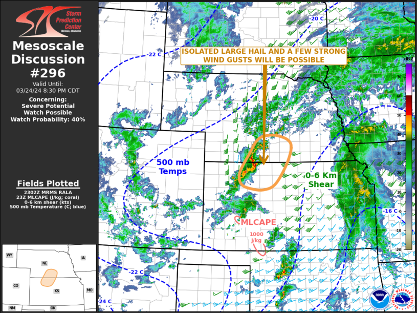
| Mesoscale Discussion 296 | |

|
|
   Mesoscale Discussion 0296
   NWS Storm Prediction Center Norman OK
   1104 AM CDT Sun Mar 30 2025

   Areas affected...East-central/southeast Missouri...southern Illinois

   Concerning...Severe potential...Watch likely

   Valid 301604Z - 301800Z

   Probability of Watch Issuance...80 percent

   SUMMARY...A watch will likely be needed, particularly for areas near
   and east of the Mississippi River. All severe hazards are possible
   with a mix of linear segments and supercells.

   DISCUSSION...A prominent shortwave trough is evident on water vapor
   imagery in central Missouri. Tied to this feature, weak convection
   has been slowly deepening in parts of eastern Missouri as it moves
   northeastward. Downstream of this, temperatures in southern/central
   Illinois have risen into the low 70s F given the more broken cloud
   cover. The general consensus of short-term CAM guidance is that
   convection will strengthen in the vicinity of the Mississippi River.
   This seems reasonable given current environmental trends. That being
   said, the need for a watch in the short term is not entirely
   certain. Potential for a watch in the next couple of hours,
   particularly for portions of southern Illinois, are higher than
   points to the west.

   Storm mode is expected to be a mix of linear segments, especially
   with northward extent, and some supercells (more likely towards the
   Ohio Valley). Steep mid-level lapse rates will support large to
   very-large hail with initial or sustained supercells. Fast moving
   storms and enhanced low-level flow will promote swaths of wind
   damage. The tornado threat is somewhat less clear, but will be
   maximized with any discrete storms. Line-embedded circulations/QLCS
   tornadoes are also possible given sufficient low-level hodograph
   curvature. A strong tornado or two could occur.

   A watch will likely be needed by early afternoon. Exact timing is
   not clear and some locations west of the River may not destabilize
   enough in the short term for an organized severe threat.

   ..Wendt/Smith.. 03/30/2025

   ...Please see www.spc.noaa.gov for graphic product...

   ATTN...WFO...PAH...ILX...LSX...SGF...

   LAT...LON   37079078 37259107 37579124 38099134 38649120 39069083
               39749035 40118977 40188936 40118870 39698827 38438813
               37738856 37128987 37079078

   MOST PROBABLE PEAK TORNADO INTENSITY...100-130 MPH
   MOST PROBABLE PEAK WIND GUST...65-80 MPH
   MOST PROBABLE PEAK HAIL SIZE...1.50-2.50 IN
|
|
|
Top/All Mesoscale Discussions/Forecast Products/Home |
|
