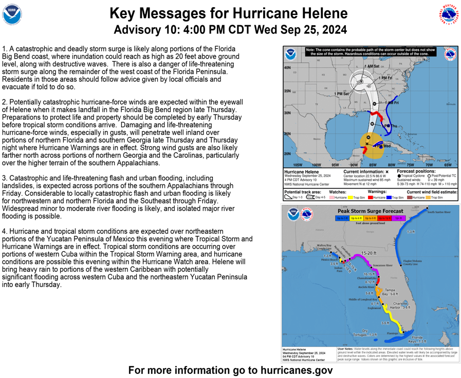
Hurricane Helene is showing signs of strengthening with a visible ragged eye and improved structure. Currently, it has an intensity of 75 kt, expected to increase significantly while moving across the Gulf of Mexico towards the Florida Big Bend coast. Helene is forecast to reach Category 4 intensity (115 kt) before making landfall Thursday evening. The storm will cause catastrophic storm surges up to 20 feet, hurricane-force winds, and life-threatening flooding impacting Florida’s Big Bend region and extending well inland into the southeastern U.S. Preparations for these severe conditions should be completed promptly. Helene’s effects will also be felt in the northeastern Yucatan Peninsula and western Cuba with heavy rain and potential flooding.
